MARIELENA ALCARAZ MAY 8, 2019
Actionable Recommendations on Improved Transportation & Mobility from Earth2Green’s Sustainable Neighborhood Assessment
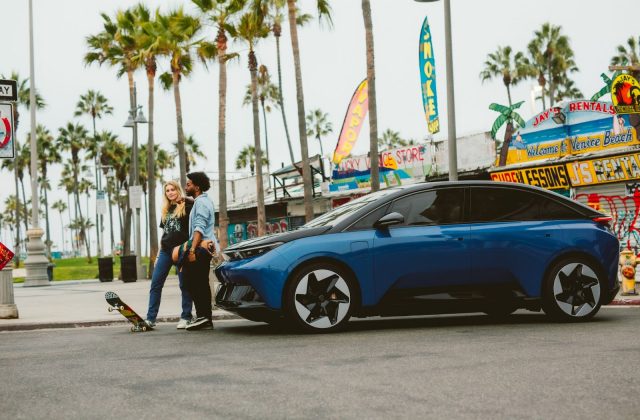
Too many cities in the US rely heavily on personal vehicles as the primary mode of transportation causing miles of traffic, longer commutes to work or shopping centers, as well as wasting space that can be better used for other purposes. Recently, cities have looked into incorporating new ways of travel to reduce congestion, increasing the mobility of more people while also using less space, and reducing air pollution by reducing greenhouse gas emissions.
The Main Challenge
A pattern rose from each of Earth2Green’s Sustainable Neighborhood Assessments: designing streets for cars, rather than for people, disrupts neighborhood connectivity, discouraging walking and hampering pedestrian safety. This lack of alternative mobility ultimately, affects a thriving economy by limiting access to commercial centers, jobs, open spaces, hospitals, and schools.
Excessive use of personal vehicles causes hours of traffic, making a 20-minute commute last up two hours in highly congested cities. Providing other forms of transportation, such as protected bike lanes, trains, buses or trams, reduces the number of vehicles on the street; therefore, allowing more residents to move from neighborhoods to commercial and city centers. Reducing the number of vehicles on the streets transforms a city to become healthier, highly dynamic, and equitable.
Although you may believe your vehicle-dependent city is impossible to transform, the following recommendations from previous Earth2Green Sustainable Neighborhood Assessments provide actionable items to transition mobility needs within your city. Recommendations are grouped as follows: (1) Designing for Pedestrian Safety, (2) A Cycling City, and (3) Useful Transportation Hubs.
Recommendations for Multi Transportation Use
Design for Pedestrian Safety
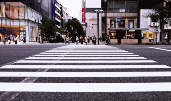
(1) Clearly Marked Crosswalks
(2) Split Long Blocks
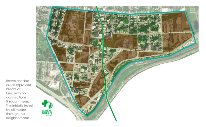
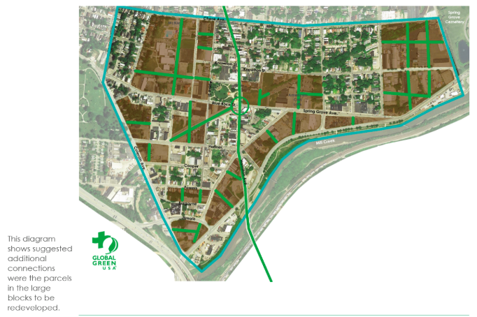
Smaller blocks encourage walking. The added intersections also improve connectivity by creating new routes shortening the distance on getting from point A to point B. The following map shows an example on how a neighborhood in Cincinnati, OH would look with additional intersections and smaller block sizes.
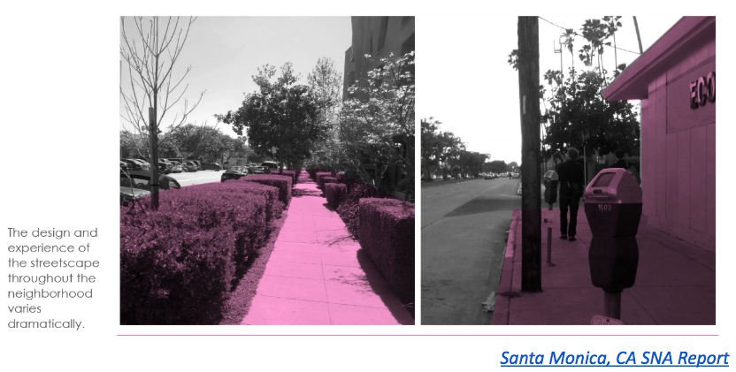
(3) Improve Sidewalks with Trees and Lighting
Empty sidewalks are not comfortable or safe to walk in. At night, appropriate street lighting keeps pedestrians safe from incoming cars, especially at intersections and crosswalks. On the other hand, tree coverage provides shade from the heat during summer days. But trees add other benefits to the city as well. Trees increase city aesthetics, reduce surface temperatures, and function as flood protection.
A Cycling City
(4) Extend Existing Bike Lanes
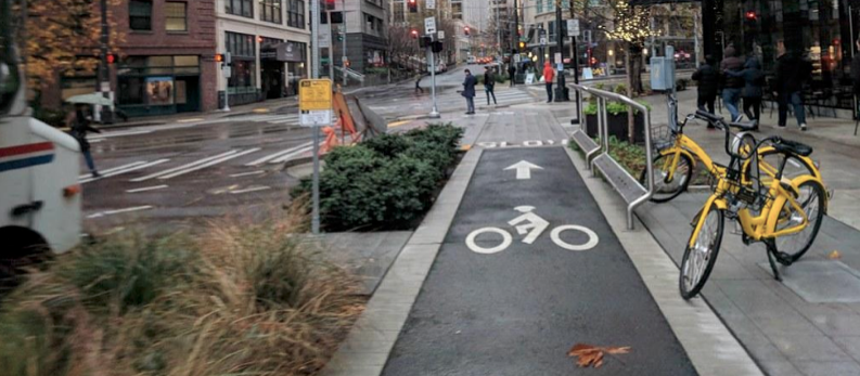
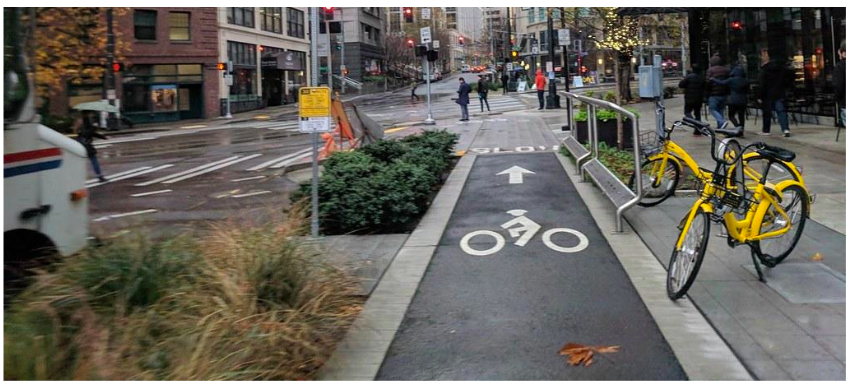
Identify streets that would benefit from extending existing bike lanes. Neighborhoods within a city can benefit from having added bike infrastructure that connects them to roads leading to commercial centers. Also, consider designing protected bike lanes by adding a physical buffer between car lanes and bike lanes, as shown in the example below.
(5) Provide Bike Racks at Park Entrances
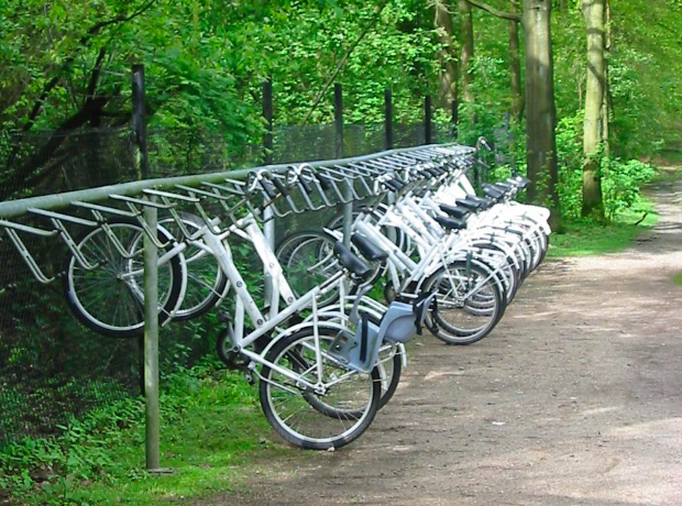
This makes parks and open spaces more accessible to cyclists when connecting bike networks from neighborhoods. It also increases city equity by allowing far away neighborhoods to enjoy open spaces.
(6) Build Bicycle Storage facilities
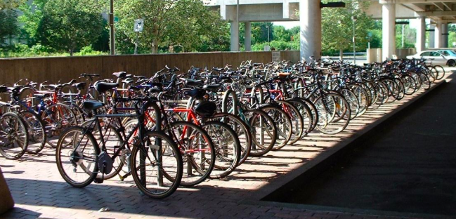
Building bicycle storage facilities in residential buildings and transportation hubs promotes bike ridership. Cyclist can ride to transit hubs, store their bikes in facilities and take other, faster forms of transit to city centers.
Multi-Use Transportation Hubs and Streets
(7) Integrate Bus Services and Shuttle Facilities near Train Stations
Many neighborhoods are not connected to train stations, requiring some other form of transportation (mainly, a car) to gain access. This defeats the purpose of reducing congestions, as a majority of residents would rather continue their commute by car, than to find a parking spot for their car, buy tickets to a train, and walk to the platform. To boost the use of new and existing train station, shuttle services and buses should connect neighborhoods to the stations.
These stations can also accommodate amenities, such as food carts, shops, and internet services, increasing use and attractiveness.
(8) Transform Multilane Streets
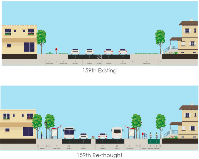
Multi lane streets already have the space to support a public transit system, such as bus only lanes. A healthy public transit system allows cities to limit parking development; ultimately, reducing congestion and allowing space for other amenities; such as parks, retail space, or street vendors.
Here is an example on how to rethink a street from Oak Forest, IL
These are just a few actionable steps cities can take to transform mobility, increase connectivity and transition to sustainable neighborhood design. Earth2Green’s Sustainable Neighborhood Assessment reports includes additional strategies on increasing neighborhood sustainability beyond transportation.

